Australia Weather News
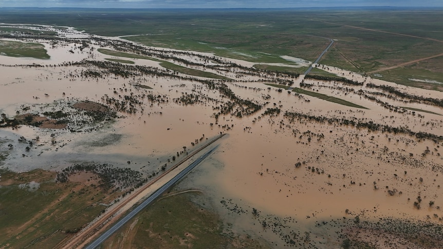
Flooding captured near Tibooburra in north-west NSW following heavy rain this week. (Supplied: Richard Norris)
At least four states across Australia are facing extreme weather and heavy rain sparked by a rare weather pattern sitting above the Simpson Desert.
South Australia, Victoria and south-west NSW are forecast to receive what could be the heaviest rainfall in more than a decade.
"If you got away with a dry week this week in Australia you're probably in the minority," said Angus Hines, senior meteorologist at the Bureau of Meteorology.
"It certainly has been a wet week over large parts of the country, especially through the interior, which of course is typically a very dry climate," he said.
"So this rain has been very unusual in many respects."
Mr Hines said a lot of the rain was driven by singular weather system.
A slow-moving tropical low-pressure system has been sitting over the south-east of the Northern Territory for several days, drenching outback areas over multiple states.
In Greater Sydney, intense rainfall last night left more than 3,000 people without power.
In just three hours the State Emergency Service (SES) carried out 40 flood rescues.
Since the start of the deluge it said it had received more than 490 calls for help.
Western Sydney saw a dozen homes evacuated due to flash flooding that inundated roads and backyards.
Conditions are set to ease today.
Further south in Victoria, storms swept across the state on Tuesday dumping 50 millimetres of rain in some areas.
By 8pm on Tuesday night, the SES had received about 290 calls for help for flooding and building damage.
In Western Australia, more than 10,000 lightning strikes were recorded across the state's south as thunderstorms moved across the area.
One man in his 70s was rushed to hospital after being struck by lightning while walking his dog in Perth yesterday morning.
The dog did not survive.
A few hours later, paramedics were called to a school in the city's east to treat two teenage girls after lightning struck near them.
No more thunderstorms are forecast for the region over the next week.
Many of the driest locations in Australia and northern South Australia have an average annual rainfall of 150 to 200mm.
"We've seen lots of places get over half of their annual average rainfall this week," Mr Hines said.
"Some places it's getting quite close to the full years' worth of rainfall in the past seven days. So just persistent, unusually wet conditions over the outback."
The rain has led to widespread flooding over outback Australia, washing away parts of the East West rail line and forcing the route to close.
The Australian Rail Track Corporation said sections of track "up to 100 metres in some locations" had been swept away.
Other areas, including north-west Queensland's Mount Isa, have reached new rainfall records.
The usual red, dry dirt turned to rivers and lakes as 318.6mm of rain hit the mining city this month.
More rain is forecast in coming days.
For some communities this latest bout of rain means even more isolation, stretching out an early wet season.
In the Gulf of Carpentaria some flood-prone areas have been cut off for months.
The Bureau of Meteorology has issued its long-range forecast for March, noting rainfall is "likely to be above average for much of northern Australia and parts of the New South Wales north coast".
ABC