Australia Weather News
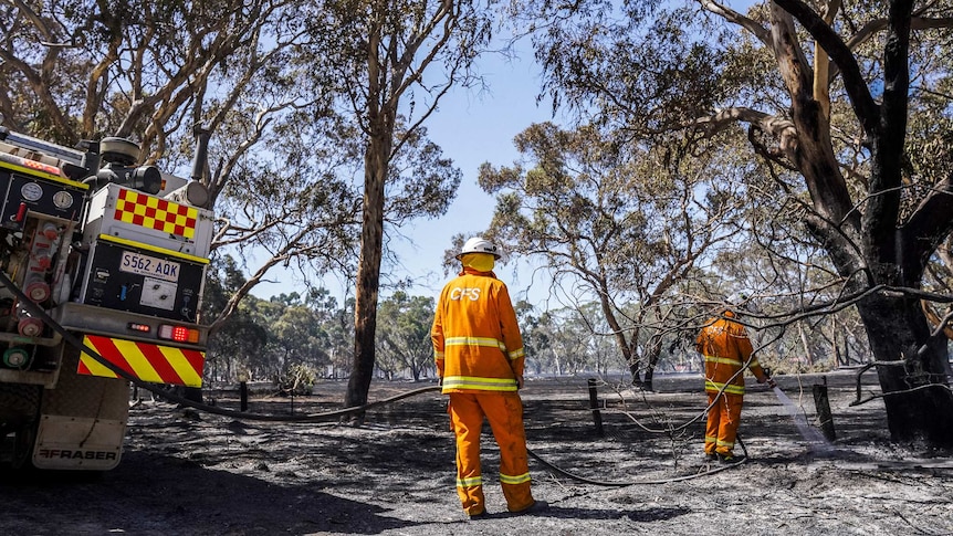
The CFS is warning of significant fire weather, with the Bureau of Meteorology forecasting temperatures in the mid-30s for Adelaide and dry conditions across the state on Thursday. (ABC News: Bec Whetham)
The South Australian Country Fire Service and Bureau of Meteorology are warning of high fire risk conditions tomorrow.
BOM has issued a fire weather warning with extreme fire danger forecast for the Eastern Eyre Peninsula, Flinders, Mid North, Yorke Peninsula, Riverland, Murraylands, Upper South East and Mount Lofty Ranges on Thursday.
Hot and dry conditions combined with fresh and gusty north-westerly winds are expected.
"A gusty south-westerly change is expected in the afternoon and evening. There is also the risk of high-based thunderstorms with dry lightning over south-east parts of the state in the afternoon and evening," the warning reads.
CFS Deputy State Controller, Brenton Hastie said "fires under those conditions can be problematic for crews".
"Tomorrow will not be a day to be taken lightly," he said.
"We are seeing hot temperatures, windy conditions ... on top of recently observed fires on non-total fire ban days that have been difficult to control."
He said the CFS wanted to remind people to be careful in conducting their activities "wherever you are" and ensure bushfire survival plans were complete and communicated with family members.
He also asked people to avoid any high risk activities in order to reduce fire risk.
"We know that there's always going to be fires no matter what," he said.
"But there are the avoidable fires — which is always disappointing to see — that you know, due to people being careless, result in our volunteers being called away from home and work and needing to spend many hours out in the fire ground when they would much prefer to be doing something else.
"Not only that, it does create a risk for the community as well. So it is really easy to prevent most fires and so we're just encouraging people to think about their activities tomorrow."
BOM Emergency Services Meteorologist, Christopher Kent said it had been a "quiet start to the fire season this season due to an unusually cool November".
"On average, SA's maximum temperatures were half a degree below average, which is the coolest since 2022, and it was even cooler across southern parts of the state," he said.
"Some areas also experienced above average rainfall as well.
"These conditions led to the first total fire ban being issued on the 24th of November, which is the latest first total fire ban of the season in 20 years."
But, he said tomorrow's conditions were looking challenging if fires were to ignite.
"Tomorrow, temperatures are expected to climb into the mid to high 30s across the agricultural areas and into the low 40s across the north, which is 8 to 10 degrees above average for this time of year."
He said Port Pirie was expected to reach 39 degrees on Thursday.
"Adding to the concern for tomorrow, the dry and gusty north to north-westerly winds will reach 30 to 40 kilometres per hour at their peak. These will develop during the late morning ahead of the dry change."
He added a cool change was expected to move through Adelaide and the Mount Lofty Ranges during the late afternoon on Thursday, with cooler conditions forecast for the weekend.
ABC