Australia Weather News
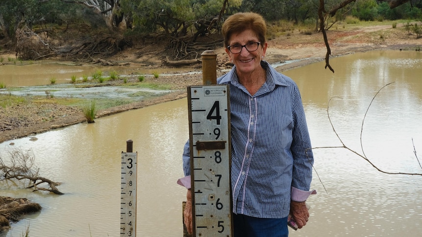
Nan Pike wants to see more automated river gauges in the Paroo River. (ABC Rural: Maddelin McCosker)
For generations, when remote properties were cut off from floodwaters, graziers could rely on the old "bush telegraph" for updates on river heights.
They would call their upstream neighbour for the latest flooding information to get an idea of what was coming.
However, as the carbon farming industry has grown across the Paroo Shire, many properties have been left without managers or caretakers.
With fewer owners on the land, the bush telegraph has fallen silent, leaving those who remain without neighbours to provide important information.
The loss was felt during flooding in the region earlier this year, including in Eulo, 850 kilometres west of Brisbane.
"Water went where people didn't know it would go," Eulo grazier Rhi Newsham said.
"We don't have a lot of neighbours.
"It makes it really difficult to get the right information about what's happening, where it's happening and when."
Record-breaking flood 'unnerving'
The Paroo River has an automatic gauge at a property called Humeburn, at the northern edge of the shire boundary.
The next flood warning assets are manual flood markers at the Eulo bridge, 100km away.
In April, flood levels in Eulo peaked at a record 6.5 metres and upstream at Humeburn levels reached 8.5m.
[IMAGE — Eulo Humeburn Hungerford map]The person responsible for reading and reporting the flood levels in Eulo is longtime local Nan Pike.
Mrs Pike was away during this year's flooding event, which she said was "quite unnerving", but someone else in town was able to collect the levels.
During a flood, when the river level reaches 2.6m, the markers are checked at least three times a day and reported back to the Bureau of Meteorology.
"It's not a job people want to do," Mrs Pike said.
"But I've got an interest in the river and I like for people to know what's going on.
"They can only operate with the information that's fed to them."
Mrs Pike said the automatic gauge at Humeburn was "crucial" for locals downstream and wants more installed along the river system.
"There's nobody [upstream] to say what's happening and when it's coming," she said.
Mrs Newsham agreed more gauges were needed.
"Had there been reliable gauges along the river, there would have been less anxiety … and better preparedness at this end," she said.
"We're not asking for people, we're asking for technology and I don't think that's too big of an ask."
Improved infrastructure commitment
The Paroo Shire Council is petitioning the Bureau of Meteorology for at least two more automated river gauges between Humeburn and Eulo.
"I think the bureau is looking at automating the Eulo gauge, but one or two in between is really necessary," Paroo Shire Mayor Suzette Beresford said.
A spokesperson for the Bureau of Meteorology said it was working closely with local governments in Queensland to improve flood warning infrastructure.
The bureau will acquire and upgrade 1,600 existing local government-owned flood assets over 10 years, as part of a $236 million program.
"Under this program, the bureau is seeking to acquire, upgrade and maintain three Paroo Shire Council-owned flood assets in the Paroo River catchment," the spokesperson said.
The bureau is also automating about 160 existing manual flood assets and under this project will automate four manual gauges within the Paroo River catchment, at Eulo, Quilpeta, Hungerford and Allambie gauges.
ABC