Australia Weather News
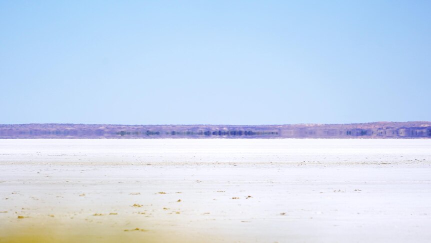
The salty surface of Kati Thanda-Lake Eyre in South Australia's outback. (ABC News: Sarah Maunder)
Australia's biggest lake is believed to have reached capacity on only three occasions in the past 160 years, but the mass of floodwater now flowing into Kati Thanda-Lake Eyre is raising hope, as well as river levels.
On maps of Australia, the great inland salt lakes are often shaded in blue.
The colour suggests the presence of water, which can be misleading, especially for the biggest of those lakes.
For all but a fraction of the past century, Kati Thanda-Lake Eyre has mostly been an expanse of dry, crusty salt.
About 700 kilometres north of Adelaide, and 400km from the nearest coast, the lake sits below sea level in an area of extremely low rainfall.
South of the Simpson Desert and surrounded by sandy soil, the lake stretches to the horizon, shimmering with the heat reflecting off the sun-baked surface.
But that's all about to change, because Kati Thanda is once more starting to live up to its reputation — not just as a lake, but as an inland sea.
Floodwaters caused by record-breaking rainfall are flowing from south-west Queensland into north-east South Australia, and making their way into the lake.
"What you're seeing, especially in the evening if you're flying past it, is this reflection of glass — or a mirror with the sun going down," says outback pilot Trevor Wright.
"It's the most [water] I've seen in the Channel Country since I've been up there."
The tourism operator has previously likened the broad upswell of water to an "inland tsunami".
"I think there were two things that really hit me more than anything: the speed it was travelling at, and the sheer area it was covering," Mr Wright says.
Altitude offers perspective, as Mr Wright knows only too well — but it's not necessarily from the cockpit that the full picture emerges.
NASA satellite images from the past fortnight show the water's slow but steady spread.
At first appearing as a mere trickle, the water bleeds across the lake's surface, turning the white to brackish brown.
It's an illustration of the fact that the lake is also the final destination for water across the 1.2 million square kilometres of the Kati Thanda-Lake Eyre Basin.
That last word is fitting in more ways than one, because the lake acts as a giant sink, drawing water towards it from across a broad area of rivers, creeks, channels and flood plains.
At its deepest — 15.2 metres below sea level — it is the lowest natural place on the surface of Australia.
"What's coming into the lake and how quickly it's started to cover the lake and fill the lake has been mind-boggling," Mr Wright says.
"It's the rebirthing or the re-flourishing of the environment and it's just a complete and utter exuberance of life."
According to South Australia's National Parks and Wildlife Service (NPWS), Kati Thanda-Lake Eyre has filled to capacity just three times in the past 160 years. Partial fills happen every so often, but are less spectacular.
The benchmark is the 1974 flood — an event that Bobby Hunter remembers fondly.
The Yankunytjatjara man was just 18 years old when the lake last received a total fill and flooded to a depth of six metres.
The arid landscape was transformed into an outback oasis, turning the land a lush green and attracting diverse wildlife.
"It was an incredible time," Mr Hunter says of the 1974 flood.
"As the months and that went by, the lake was as blue as the sea by July and August.
"You sort of imagine a ship might come along in a minute or something.
"After a while, [we] got a lot of pelicans, thousands and thousands of them.
"A lot of fish had started coming down, the first animals [to] really come around, I think, were seagulls, you had all sorts of different birds."
NPWS district ranger Travis Gotch expects the upcoming fill to produce similar effects.
"The exciting bit is the ecology as the water level comes up," he says.
"Fish are already breeding up in the river systems and coming down with the rivers.
"The lake will go relatively fresh, and then it'll go to salt [water].
"You also get a whole heap of macroinvertebrates and other crustaceans, and they're forming up and building up in huge numbers in those river systems and then into the lake itself."
Flocking to the lake
For people who haven't before visited Kati Thanda-Lake Eyre — or outback South Australia — it can be hard to appreciate just how remote the area is.
Marree is a small town south of the lake that acts as an outback crossroads.
It is at the northern end of the Outback Highway, and at the junction of the Oodnadatta and Birdsville tracks.
Once you leave Marree for Kati Thanda-Lake Eyre, the Oodnadatta Track is unsealed.
The local hotel advises visitors to travel with water and a torch, and warns them to be aware of the scorching daytime heat, "damn cold" conditions at night, and unreliable phone coverage.
The 200km trek from Marree to William Creek — which is considered the "gateway" to the lake — follows the unforgiving and unsealed Oodnadatta Track.
Online travel guides recommend using a four-wheel drive to navigate the unsealed road.
More than 60km from the edge of the lake, William Creek is nevertheless the closest town to Halligan Bay, which is one of the few public lookouts.
Trevor Wright, who has been offering scenic flights over the lake since the early 2000s, owns the local pub — an establishment that bills itself as one of the world's most remote hotels.
Food and supplies are delivered once a week.
Flying above Kati Thanda-Lake Eyre almost every day in peak tourist season, Mr Wright is intimately familiar with the landscape, its changing moods, and its fluctuating fortunes.
At the start of 2025, he was considering scaling back his business because of a lack of visitors.
"We were looking at really closing up and cutting down, and just operating at a very basic level," he says.
But the water has made all the difference — not only is it rejuvenating the landscape, it's also replenishing local tourism.
"You saw it coming towards South Australia — that's when I realised that, 'Hey, we could be in for a major tourist event'," Mr Wright says.
"What it's actually done is it's kept people's jobs, because [people] are needed in hospitality, tourism or even just in maintenance."
Truck driver Tim Taylor delivers aviation fuel to remote areas, and is feeling the flow-on impact.
"In the summertime, like anywhere out here, there's just no tourists because it's just too hot," he says.
"But when there's water in that lake and it's come tourist season, that's when it fires right up — and it's hard to keep up with it, it's just that much."
Despite the lake's remoteness, tourists eager to see it and get a taste of outback life have already started to make the pilgrimage.
"We like to see a lot of these out-of-the-way sort of places, so this has ticked a box for us," says Brisbane tourist Glenn, who had stopped off at the hotel.
Melbourne woman Anita was on her way back from a wedding in Airlie Beach in Queensland, and decided to go via the lake.
"It's beautiful, absolutely beautiful — the blue colour and the terrain is amazing," she says.
Protecting a special place
The Kati Thanda-Lake Eyre Basin stretches across almost one-sixth of Australia, including parts of South Australia, the Northern Territory and Queensland, and a small part of New South Wales.
It is one of the world's largest internally draining river systems, meaning its water doesn't reach the ocean.
Instead, the water flows into the lake and when it stops flowing, it evaporates.
The lake, which covers more than 9,000 square kilometres, was named after English explorer Edward John Eyre who documented the area in 1840.
Its vastness appears to have overwhelmed early European explorers.
In a 1906 book on central Australia, British geologist John Walter Gregory noted that while some characterised the area as "a fertile land of lakes" others described it as a "desert of the worst type".
"Lake Eyre was dry — terrible in its death-like stillness and the vast expanse of its unbroken sterility," wrote explorer Peter Egerton Warburton in the 1860s.
While Warburton found it difficult to tell "whether I saw before me earth, water or sky", Gregory described the area "as of especial importance in the natural science" of the continent.
"For Lake Eyre, with its coasts and estuaries, was once the living heart of Australia," he wrote.
For the Arabana people, who were granted native title over land covering most of the lake in 2012, it holds deep spiritual significance in Arabana dreaming.
"This extensive legal process recognised in Australian law what Arabana people had always known — that they had always been connected [to] this country, and that their connection had remained unbroken since the arrival of Europeans," the lake's new management plan states.
The Dieri people were recognised as the native title holders over the eastern portion of the lake, which was renamed in its entirety in 2012 to include the Arabana term "Kati Thanda".
The landscape's cultural and ecological significance is protected by laws and regulations — some old, some new — which restrict recreational activities, including swimming, boating, driving and landing aircraft.
The rules are, at least in part, intended to protect airborne arrivals of an entirely different kind.
"We've got a number of birds obviously breeding on the islands [in the lake]," Mr Gotch says.
"You've got birds that are flying all the way from Siberia to undertake a major breeding event that are listed as endangered globally.
"They don't want to be being bothered and we're trying to keep that sustained for them and protected as well."
Will the lake reach 1974 levels?
It's not uncommon to hear flows into Kati Thanda-Lake Eyre described as a "once-in-a-lifetime" event.
The claim should always be taken with a pinch of salt — previous partial fills have been as recent as 2019 and 2010.
But the big question on many locals' lips is, will this year's big fill be as big as the flood of 1974?
At the Lake Eyre Yacht Club, which is headquartered in Marree, commodore Bob Backway is doubtful the event will be on that scale.
"The lake won't fill," he says.
"To fill, basically, all hell has to break loose. South Australia is in drought at the moment.
"It's not going to be anything like 1974."
That might be described as the "lake half-empty" perspective — but Mr Backway also takes a "lake half-full" view.
"It'll be the biggest flood we've had since 1989 when it got to 3.6 metres deep," he says.
"We've got a very big flood — the biggest flood I've seen on the Warburton River — but that will probably fill the lake to about 2.5 metres deep, which still means that 3,500 square kilometres will be covered."
Mr Gotch also believes the incoming water will fall short of the 1974 level.
"My gut feel is it will be roughly around the same level as the 2010 floods, which will sort of put it up, you know, a couple of metres deep," he says.
"We'll have water in the lake for six to 12 months, depending on how hot the summer is."
At a small community in north-eastern SA, locals have been placing bets on the water level.
"They've all chucked in $10 at Mungeranie," Bobby Hunter says.
While Mr Hunter agrees the flood of 1974 is unlikely to be matched this time round, he's open-minded.
"You need two years [of rain] and everybody knows there was the big rain in Queensland, but you need a lot of local rain too," he says.
"It might take another year.
"Who knows what might happen?"
Credits
Authors: and
Reporting: Sarah Maunder and
Digital production: Daniel Keane
Photography: Sarah Maunder, Stephen Opie and Guido Salazar
Graphics: Stephan Hammat
Drone footage: Stephen Opie
Video production: Amanda Kerr
Additional videos and photos: Trevor Wright, ABC Archives, National Archives of Australia, NASA Worldview, Trove
Editing:
ABC