Australia Weather News
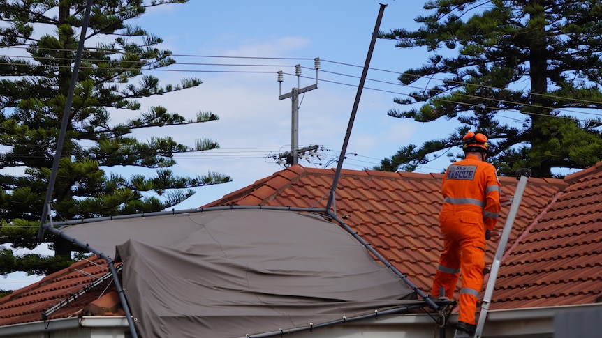
An SES crew member retrieves a gazebo from a rooftop in Osborne during a wind event on Monday. (ABC News: Isabella Carbone)
Damaging winds of over 100 kilometres per hour are expected across western and central parts of South Australia, and 90 kilometres per hour for Adelaide and the Mount Lofty Ranges from late Monday morning.
The Bureau of Meteorology has issued a severe weather warning for several districts including Adelaide, the Mount Lofty Ranges, Eyre and Yorke peninsulas, Flinders, Mid North, Kangaroo Island, Riverland, the South East and parts of the West Coast, North East Pastoral and North West Pastoral districts.
Senior BOM forecaster Michael Efron told 891 ABC Adelaide some parts of the state, including the West Coast, Eyre Peninsula and Yorke Peninsula could see wind gusts of 100 kilometres an hour.
"Wind gusts of up to 90 kilometres an hour are possible especially this afternoon, into the evening and the early hours of Tuesday," he said.
A risk of a thunderstorm was also issued for late Monday morning, with 3 millimetres to 10mm of rain expected on Monday, and 5mm to 10mm on Tuesday.
"Do take care if you’re out and about today and tomorrow," Mr Efron said.
The State Emergency Service said people needed to move vehicles under cover or away from trees and secure loose items around properties.
It also advised people to stay indoors and away from windows while conditions were severe.
On Monday afternoon, BOM Meteorologist Angus Hines warned of severe weather impacts including damage to trees and property, hazardous driving conditions and power outages.
“When we have winds of this intensity, trees pushing down onto houses or cars happens all the time,” he said.
"We will often see power outages with winds this strong, especially when they cover such a broad area as they are this week."
A coastal hazard warning was also issued.
"Winds will be a significant factor, but not the only factor, particularly for people who live on or near the coastline because we will be seeing the combination of some really large waves with some abnormally high tidal levels along some parts of South Australia," Mr Hines said.The warning is in place for Monday and Tuesday but primarily during the Tuesday afternoon high tide when the water level is expected to be highest.
"It's extensive," Mr Hines said.
"The warning stretches from the Nullarbor coast, past Ceduna, the Yorke and Eyre peninsulas, the Adelaide coast and down to the Limestone Coast, and southern parts of South Australia, across the border into western Victoria."
Emergency Services Minister Rhiannon Pearce also warned South Australians to "stay alert" and "avoid unnecessary danger" during the severe weather event.
As of 3:00pm, SA Power Networks reported 21 outages were affecting more than 4,000 customers across South Australia.
ABC