Australia Weather News
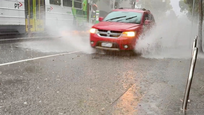
Intense storms have dumped heavy rain across Melbourne, prompting warnings for people to shelter indoors. (ABC News: Billy Draper)
Storms have been rolling through Melbourne as heavy rain falls across a large section of central Victoria.
Two emergency warnings were issued at 2pm for severe thunderstorms affecting a large area stretching from Sunbury, north-west of Melbourne, through St Albans to Coburg, Preston and down to Melbourne's CBD.
They also included an area from Healesville to Yarra Junction and out past Warburton, east of Melbourne.
By 3pm, the emergency warning had shifted away from Sunbury across Melbourne's north to include eastern suburbs such as Doncaster and Greensborough and further south-east including Danendong, Berwick and near Pakenham.
Thunderstorms were detected near the area east of Pakenham and Bunyip just before 4pm, and were moving further south-east.
The storms dumped almost 40 millimetres of rain at Spring Hill, north-west of Melbourne, in just over an hour.
Another storm cell had developed over north-west Victoria at 3:30pm, with heavy rain predicted for Swan Hill, Ouyen, Kerang and Birchip.
State Control Centre spokesperson Josh Gamble said heavy rain was continuing across Victoria's east this evening as the second storm cell continued to move across from the state's west.
"We've generated about 220 jobs for our SES volunteers … around Heidelberg, Craigieburn, Fawkner, Gisborne and Knox," he told ABC Radio Melbourne.
"We've got a mix of building damages with rain through roofs, 'potential to enter premise' — so water on the ground entering doorways — and trees down on the road."
Mr Gamble said some towns had torrential downpours while rain in nearby areas hardly reached a notch on the gauge.
"If you look at Redesdale, it got 0.4 mills of rain over today and then you look at Trentham some [50 kilometres] to the south and they've received roughly 30 mills."
Mr Gamble said the rain would continue overnight as the storms moved out to Gippsland and away from the state.
"We're still expecting those storms to still have some go in them, so heavy rainfall, potential for flash flooding, as well as hail," he said.
"We're still asking the community to stay indoors and monitor those warnings."
Bureau of Meteorology senior forecaster Daniel Hayes said some areas had received almost 1mm of rain per minute.
"The main risk is this rain comes down very heavily and can lead to the rise of drains and floodways and creeks and so forth in areas where people may not have expected them."
About 9,000 properties were without power at 7pm.
Citipower and Powerco spokesperson Emma Tyner said 890 customers lost power in the Sunshine North area in Melbourne's west after lightning hit a pole, while in the northern suburbs, 765 customers in Northcote and more than 1,000 in Thornbury had been disconnected.
Ms Tyner said crews were working as quickly as possible to restore power.
"We certainly ramped up resources leading up to today. We've been monitoring this weather for some time, so we're ready to respond," she said.
Callers told the ABC that outbound lanes at the railway underpass on Dandenong Road at Caulfield Road were flooded just after 3pm, along with sections of Canterbury Road city-bound at Bayswater North.
Another caller from Ballan said he had recorded more rain in 30 minutes than he had since the start of the year.
Meanwhile, Michael in Bendigo said the skies were clear and there had not been a drop of rain.
Authorities warned rain in bushfire-affected areas could create the potential for landslides and wash debris, such as ash, soil, trees and rocks, into local waterways.
ABC