Australia Weather News
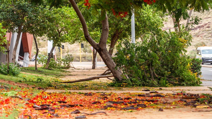
Karratha was forecast to be hit with destructive winds and heavy rain as Tropical Cyclone Mitchell passed close to the north overnight. (ABC News: Kelsey Reid)
Communities along Western Australia's Pilbara coast are bracing for another day of wild weather, as Tropical Cyclone Mitchell continues to track along the coast.
The cyclone is currently at category three strength,and is approaching Onslow.
The cyclone's progress along the coast slowed late on Saturday, leaving Karratha to be hit with recorded wind gusts nearing 100kilometres per hour overnight.
An emergency cyclone warning remains in place, with emergency services and locals yet to fully assess the damage from overnight.
Karratha recorded 90 millimetres of rain in the 24 hours to 9am today, and wind gusts have begun to ease.
Much stronger conditions were experienced on the region's offshore islands, with gusts of 137 kilometres per hour recorded on Barrow Island.
With Karratha's emergency warning lifted just after 9am on Sunday, residents were also making the most of some long-awaited rainfall.
Landfall forecast for the Exmouth Gulf
Tropical Cyclone Mitchell will continue tracking south-west along the coast past Onslow today.
The Bureau of Meteorology says it will continue at the same intensity, bringing destructive winds, abnormally high tides, heavy rainfall and possible flash flooding.
The bureau is forecasting the cyclone will make landfall close to Exmouth overnight as a category three system
An evacuation centre has opened at the Shire of Exmouth Hall.
There are also evacuation centres open in Karratha and Onslow.
The bureau said the system had slowed compared to earlier forecasts.
Senior meteorologist Miriam Bradbury said this would have mixed implications.
"The period when you might see the heavy rainfall, the period when you might see the gale force winds and damaging wind gusts, might be slightly longer than originally anticipated," she said.
"However, there is some good news in it; we are expecting to see the next high tide at Onslow around 3pm. Previous forecasts had that system moving close by, close to that high-tide mark.
"With the slowing of the system, we now should see that system moving close by some hours after that high tide."
However, there is still a risk of coastal inundation in low-lying areas, Ms Bradbury said.
"As this system moves across those open waters but close to the coast, we are expecting an elevated sea state and large waves," she said.
"The big three impacts [are] the winds, the rain and the marine impacts; we need to have them on the top of our mind throughout the rest of today."
The bureau is publishing hourly updates on the cyclone and its forecast path.
Residents bunker down
Residents in the much-loved tourist town of Exmouth are bunkering down, with destructive winds, heavy rainfall and high tides forecast.
While it is the low season for tourism, Ningaloo Caravan Park manager Rachel Wells said there were still many guests who sought more secure accommodation.
"We had around 90 campervans, rooftops. Most of them decided it would be better to go to a safe place," she said.
"Some of them have gone into chalets … I think everyone is now in a good place.
"We just have to trust we are safe, and we have done everything we can to be safe."
Engine room standstill
The Pilbara is often referred to as the "engine room" of the Australian economy, with large quantities of resources extracted and exported from the region.
Several mining companies evacuated staff ahead of Cyclone Mitchell.
Pilbara Ports shut the ports of Ashburton, Cape Preston West, Dampier, Port Hedland and Varanus Island ahead of the cyclone's approach.
The Port of Port Hedland has reopened this morning.
ABC