Australia Weather News

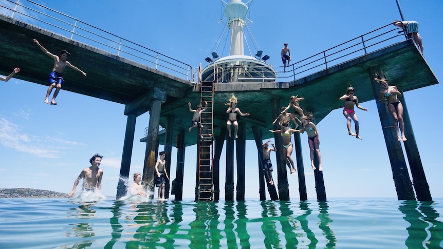
South Australians living near the coast are seeking respite at the beach. (ABC News: Lincoln Rothall)
The first major heatwave of the year enters its second day with temperatures up to 47 degrees Celsius forecast in northern parts of South Australia, Victoria and New South Wales without real reprieve in sight until the weekend.
The mercury is due to drop slightly on Thursday in coastal areas of Victoria and South Australia, but the relief is short-lived as temperatures are due to rise again on Friday.
It comes ahead of warnings of extreme fire danger weather across South Australia and Victoria on Friday, with bushfires already burning in Victoria's north.
Here is the state-by-state breakdown of what is expected over the next few days for those in the heatwave zones, and what we have seen so far:
Heatwave in South Australia
Thursday will continue to be very hot for the northern parts of the state with temperatures in the low to mid-40s.
Among the hottest towns will again be Port Augusta, which is forecast to reach a top of47Con Thursday, after hitting46.3Con Wednesday.
Adelaide will also remain hot, forecast to reach 39C after a scorching43.2C.
But the arrival of the sea breeze will ensure a slight reprieve for many other locations closer to the coast, according to the Bureau of Meteorology (BOM).
Port Lincoln, for example, will be back to its more typical weather in the high 20s after soaring to44.5Con Wednesday at the airport — a whopping 18C above average.
From Friday, a trough will begin to move eastwards through the state, signalling the start of the cool change to come.
But ahead of its arrival, conditions will peak in the state's north and east with Friday bringing yet another day of very hot temperatures accompanied by gusty winds and the potential for thunderstorms with dry lightning.
"There's the potential for dust storms through inland parts of South Australia [and] maximum temperatures very well above average on the eastern side of the trough," BOM senior forecaster Sarah Scully said.
Friday could also see severe thunderstorms, carrying damaging wind gusts up to 90km/h in the far south east of the state, according to Ms Scully.
Heatwave in Victoria
Similar to SA, Victoria's south coast will also see a slight reprieve from the baking heat on Thursday, thanks to a southerly wind change on and south of the ranges, according to the BOM.
Melbourne is expected to reach a top of just30C, after hitting41Con Wednesday before rising back up to a windy41Con Friday.
But north of the ranges, the heat is continuing to linger throughout, with towns such as Mildura and Echuca going for two more days of temperatures at or near45C.
Meanwhile, places like Shepparton and Albury are hitting tops of44Con Friday — with "extreme" level heatwave warnings encompassing large parts of north-east Victoria and south-east NSW after days without reprieve.
Coupled with gusty winds on Friday, the heat will elevate the fire danger to "extreme" and even "catastrophic" levels across the entire state.
"It's not going to be a very pleasant day. Really hot and windy and very dry with high-based thunderstorms and the potential for dry lightning," Ms Scully said.
A cooler change will take hold from Saturday.
Heatwave in New South Wales
In New South Wales, heat will continue to build across Thursday and Friday, with temperatures through inland and southern parts of the state forecast to hit the low40s.
These regions will be treated to a milder change from Saturday. But for the east coast the heat will last one day longer.
Sydney is forecast to get a top of42Con Saturday, its hottest day of the week, while western suburbs are expected to be even hotter with a forecast top of43Cin Penrith.
Canberra will also remain warm until Sunday, with a forecast top of38Con Saturday — marking its fourth day of high temperatures.
"So it's a really hot peak heat day across eastern parts of New South Wales on Saturday with the southerly change dropping temperatures on the Sunday," Ms Scully said.
Ms Scully said the hot conditions on the east coast on Saturday would be met with extreme fire danger in many areas, including Greater Sydney and the ACT.
Air quality is also expected to drop to "poor" levels in Sydney's west during Thursday, Friday and Saturday evening due to the high temperatures increasing ozone levels, according to the NSW government.
Ozone is an invisible gas which can exacerbate lung and health issues.
Heatwave in Tasmania
Though it's not been as hot as the other states, northern parts of Tasmania have also been in a severe heatwave.
Launceston got up to30Con Wednesday, and the warmer temperatures are set to continue for at least another day, with temperatures remaining in the30son Thursday.
Conditions will gradually begin to cool from Friday as the heatwave moves across the region, followed by a cold front on Saturday.
Heatwave in Western Australia
The culprit for a lot of the heat in the south-east of the state has been Western Australia's north, often referred to as the "heat engine" of the country and where hot air has been building for weeks.
While locals are used to the sky-high temperatures this time of year, the last few days have been particularly hot — even by usual January standards.
It's meant parts of the southern Pilbara, near Exmouth, and central wheatbelt have also been under severe heatwave conditions, with Meekatharra hitting44Cand Exmouth47.1Con Wednesday, along with hot nights.
Going forward, the worst of the heatwave conditions will shift further north by early next week, away from the southern and central Pilbara and closer to the Kimberley.
ABC