Australia Weather News
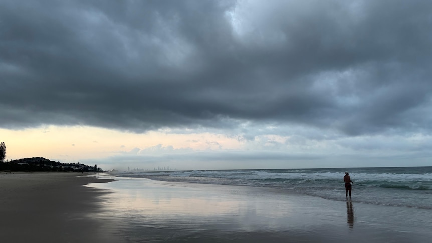
It has been a stormy few days at Gold Coast beaches. (ABC Gold Coast: Julia André)
South-east Queensland is predicted to experience its third day of severe thunderstorms in a row while much of the state sweats through heatwave conditions.
Thunderstorms are likely to continue all along Queensland's east coast into the weekend, with Brisbane once again in the firing line for heavy rain, large hail, and damaging winds.
It follows another intense night of storms across the south-east.
Parts of Brisbane City, the Gold Coast, Logan, Ipswich, Somerset, Scenic Rim, Western Downs, Toowoomba, Lockyer Valley, Redland City and the City of Moreton Bay were battered by lightning, hail, damaging winds and heavy rainfall.
Bureau of Meteorology forecaster Jonathan How summarised the forecast as "very hot, very humid, very unsettled".
"The risk of thunderstorms pretty much goes all the way up to the northern parts of the state," Mr How said.
The south-east corner has already been rocked by "catastrophic" supercell activity earlier in the week, with tens of thousands of households losing power during Monday's storm and reports of hailstones up to 14 centimetres in diameter.
Mr How said the storms today and tomorrow were likely to be less intense than previous days, but could still fall into the "severe" category.
"We are still expecting to see some large hail, but the risk of giant hail decreases each day," he said.
"The only day in Brisbane that's looking less likely to see thunderstorms is Friday. That's because we do see storms redevelop on Saturday and Sunday morning."
"Even though we are in the thick of thunderstorm season … they can produce quite significant impacts, especially for areas that have already seen damage."
Heatwave heading east
Significant heatwave conditions are moving east from inland Queensland and will affect the north-east tropical coast from Cairns to Mackay and down to the Gold Coast.
"We are expecting some very high temperatures to come through [today] and on Thursday," Mr How said.
"Brisbane will peak at 36 degrees on Thursday, places like Ipswich and Gatton 37 degrees."
"As we know, with the humidity, the feels-like temperature can be a lot higher than what the thermometer is showing.
"So very uncomfortable days and very warm nights."
Meanwhile, western and north-west Queensland are set for a reprieve from the blistering heat after seeing temperatures reach the low to mid-40s earlier in the week.
"We're seeing temperatures closer to the average for this time of year, and the heat is very much pushing its way to the coast," Mr How said.
A high fire danger has been issued for the Northern Goldfields and Upper Flinders, Channel Country, North West and the Maranoa and Warrego regions on Wednesday.
How to cool down
Thermal physiologist Matt Brearley said taking time to lower your body temperature was crucial in a heatwave.
"The biggest misconception is that hydration will fix all the ills that heat produces," said Dr Brearley, who provides advice to workers in Far North Queensland.
"Our body temperature is the biggest contributor to our heat stress, and I think most of us overlook that and just try to put out the fire with hydration."
The symptoms of heat stress include headaches, fatigue, and irritability — what Dr Brearley called the "heat hangover".
"While most people just take a break in the shade, we know that hot, humid shade is a really terrible place to cool down," he said.
Along with finding a cool, dry location, Dr Brearley had an unusual suggestion to help combat dehydration and heat stress.
"Milk is a drink that's actually an electrolyte drink but no-one talks about it," he said.
Across south-east Queensland, the heatwave will linger until the start of next week.
Mr How said the temperature and humidity would start to drop from the end of Sunday.
"The good news in the south-east corner is that once we start to see the showers clearing off on Saturday and Sunday, we do have some dry air pushing through," he said.
ABC