Australia Weather News
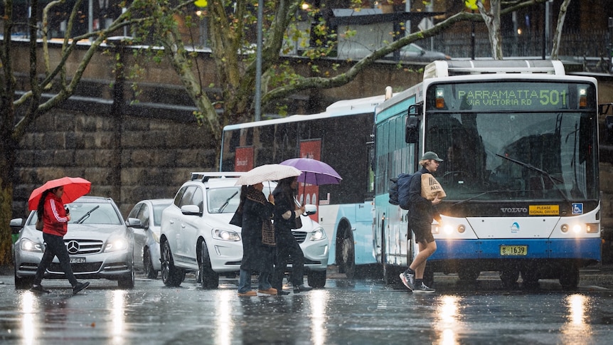
Sydney's rainfall during the past six years has been the all-time highest on record. (ABC News: Timothy Ailwood)
Sydney's wettest August in 27 years has tipped the city's recent climate into uncharted territory.
Analysing the complete weather history at Observatory Hill dating back to 1858 reveals rainfall during the past six years has been the highest on record.
Since January 2020, the city has collected more than 9,300 millimetres — beating the old record of 9,120mm from 1985 to 1990.
Considering heavy rain will continue this week and more than four months remain in 2025, the record total will surge even further above all previous six-year intervals by the end of December.
[graph 6 year rain]From drought to deluge: What turned Sydney's weather
After a severe multi-year drought from 2017 to 2019, the weather along the New South Wales coast took a dramatic turn in early 2020 when flooding rains resulted in the wettest February in three decades.
It was the start of what eventually became Sydney's wettest year so far this century — a 2020 annual total of 1,552mm against the long-term average of 1,221mm.
Another wetter than normal year followed in 2021 (1,290mm), before an improbable 2022 produced a record 2,530mm.
[graph sydneys record rain]With help from ElNiño, 2023 rainfall dipped below normal, before a quick rebound to 1,641mm in 2024 —which if it wasn't for 2022 would have been the wettest year since 1998.
2025 has replicated this recent trend. It's still only winter, and Sydney's rainfall has already exceeded the annual average.
So what's behind the unprecedented rainfall, and is it the new norm in a warmer world?
Using the National Oceanic and Atmospheric Administration Physical Science Laboratory to analyse the weather maps each day during the past few years reveals a significant anomaly.
There has been a noticeable change in the behaviour of wind along the NSW coast — since 2020 it's blowing stronger and more frequently from the east.
For example, so far through 2025 the wind in Sydney has deviated from the east by 5 kilometres per hour, a substantial swing when averaged over an extended period.
Since easterly winds arrive off the Tasman Sea, which is Sydney's main source of moisture for cloud and rain, it's no surprise this year has been wetter than normal.
The observed change in wind is associated with a climate change driven movement of pressure patterns, specifically a shift south of high pressure zones over southern Australia.
Since winds blow anti-clockwise around highs in the Southern Hemisphere, the relocation is leading to a reduction in dry westerly winds along the NSW coast, and the resulting increase in humid easterlies.
The key question though for Sydney's climate moving forward — is the past six years of rain a multi-year aberration which will correct itself, or a more permanent modification?
Only time will tell for sure, however considering other parts of southern Australia have already displayed a clear rainfall trend over the past few decades, you couldn't rule out Sydney has now transitioned to a wetter climate.
Another 100mm ahead this week
Late winter is normally one of the driest times of year for Sydney and the NSW coast, however, by late Monday the Observatory Hill weather station has already collected around three times the monthly average of 80mm.
Throughout the past three weeks, rain has fallen on 76 per cent of days, and will continue until at least Friday, by which time another 100mm is possible in the city.
This should boost the monthly total in Sydney above 300mm, enough for the fourth wettest August out of 167 years of data.
The direct cause of this week's washout is following a similar script — a high-pressure system to the south directing moist onshore winds onto the coast.
Enhancing falls is a mass of polar air drifting over south-east Australia, which should lead to heavy falls and thunderstorms over northern NSW, prompting the Bureau of Meteorology to issue a flood watch for the Mid North Coast and North West Slopes.
In the medium term, modelling indicates a switch to drier westerly winds next week, more typical of August, which should bring sunnier days to the coast.
However, while the last days of winter are looking brighter, the longer-range outlook for spring strongly favours above average rain throughout eastern Australia.
ABC