Australia Weather News
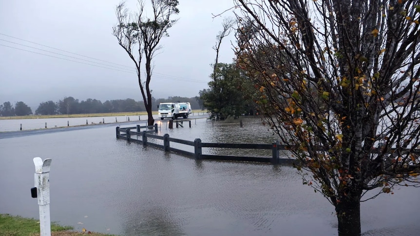
Parts of New South Wales recorded more than 300 millimetres of rain over three days. (ABC News: Romy Gilbert)
More than half a century of rainfall records have been shattered by the extreme weather that has swept through parts of the east coast and brought winds rivalling ex-Tropical Cyclone Alfred.
The Bureau of Meteorology (BOM) warned on Monday the weather event would "drench and batter" the east coast over the coming week.
Some forecasters — not the BOM — feared that the lower pressure system could develop into an "east coast low" — one of the most dangerous weather systems the region could experience.
It would have been the first east coast low in three years.
But the bureau described this weather system as a "vigorous coastal low pressure system" that brought heavy rainfall and strong winds.
University of Melbourne climatologist Linden Ashcroft said these types of weather systems were characteristic of the climate in eastern Australia but they could have devastating impacts.
"It feels like the east coast has just been battered so far this year, hasn't it? We've had Tropical Cyclone Alfred hit the northern part and now this system," Dr Ashcroft said.
"It's always very devastating when they hit, particularly in areas that just don't seem to be getting a break over the last year or so."
Highest rainfall recorded in NSW's Illawarra and South Coast regions
BOM senior meteorologist Dean Narramore said a low pressure system developed off the Queensland coast earlier this week and brought widespread heavy rainfall, damaging winds and coastal flooding to parts of New South Wales and eastern Victoria.
The Illawarra and South Coast regions of NSW recorded the highest rainfall totals, with some areas receiving more than 300mm between Monday and Wednesday.
Some of the areas with the highest rainfall totals in that time included Currarong, with 346 millimetres, Jervis Bay, with 331 mm, and Ulladulla, with 308 mm.
But this weather event has not only been about rainfall; there have been significant winds across Queensland and NSW.
A new wind gust record was set at Brisbane Airport. The BOM said wind gusts of up to 81 kilometres per hour were recorded on Wednesday night — the strongest for that site for the month of July since records began 26 years ago.
The BOM said the gusts were equal to the highest gusts recorded at the airport during ex-Tropical Cyclone Alfred in March.
On Thursday, at least nine flights between Brisbane and Sydney were cancelled due to wind conditions in NSW.
The most severe winds so far in NSW occurred at Montague Island.
Record-breaking rainfall
Most of the rainfall records were broken in the 24 hours to 9am on July 2.
Ulladulla (224 mm) had its heaviest July downpour on record, Nowra (157mm) experienced its heaviest rain in July for 25 years, Moruya Airport (147mm) had its heaviest July rain in 78 years, and Narooma (140mm) set a July record.
"So, pretty much from Wollongong down to Bega and inland towards the ranges. That's where we're pretty much seeing widespread 150-300mm in the three days," Mr Narramore said.
"Eastern parts of Victoria saw widespread 50-150mm in the three days down there. While elsewhere mostly saw 50-100mm over the last few days."
The rainfall experienced in some parts of the south-east coast saw rainfalls in the top 97th and 99th percentiles.
Dr Ashcroft explained Australia's weather systems were partially impacted by what happened in the oceans around it.
"This winter in particular, we've kind of got neutral conditions there across the board, which means for our weather, for our rainfall, kind of prepare for anything," she said.
"The Bureau of Meteorology's outlook for this winter was saying higher-than-average rainfall in the eastern part of Australia.
"We've got warmer-than-normal ocean temperatures off the east coast, which means there's probably more moisture availability in the atmosphere, and then these kinds of weather systems do happen."
For Dr Ashcroft, while these sorts of weather systems are very devastating, they are also important sources of rainfall.
It is increasingly relevant because studies have shown winter systems such as those experienced on the east coast will likely decrease in frequency, particularly under high greenhouse-gas-emission scenarios.
"Which is kind of good, in terms of impact, but it could be bad in terms of water availability. So this intense rain has a lot of impact, but it also can be an important source of water for the catchments that are being affected," she said.
"I'm not trying to downplay any of the terrible impacts that are being experienced, particularly in communities that are already tired and still cleaning up from Alfred, but it's an important source of water."
ABC